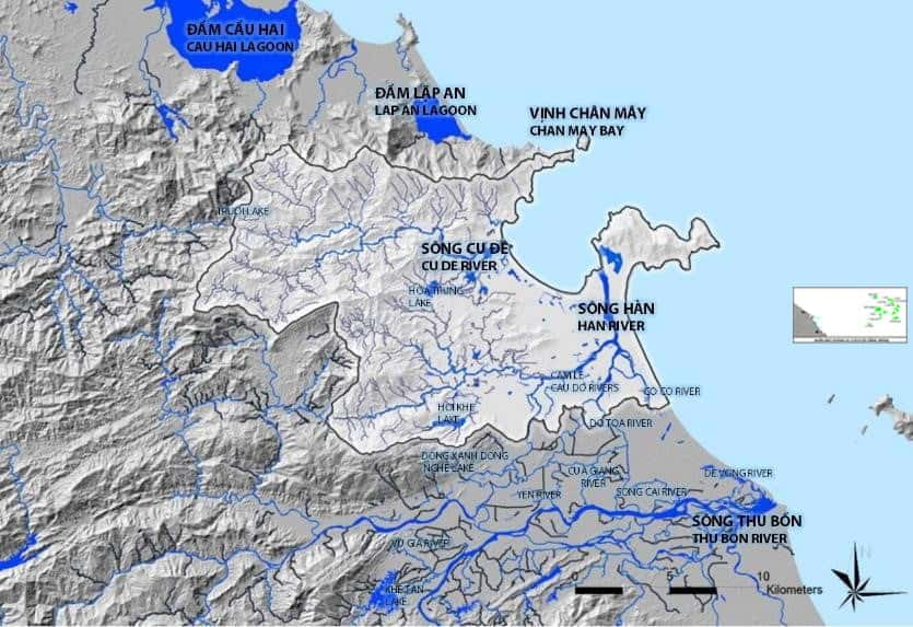
Water resources are the lifeblood of living things and the foundation of socio-economic development. However, Vietnam is facing unprecedented challenges in managing this precious resource. Pressure from industrial development, urbanization, and climate change has created an extremely complex management problem that calls for a modern, integrated, data-driven approach.
The Integrated Management Problem and Its Core Challenges
Water resources management is not simply a matter of measurement. It is a multidimensional, multi-sector, and multi-locality integrated problem that includes:
- Quantity management: Supply and demand must be balanced, and flows and water levels regulated to serve domestic use, agriculture, and industry, while also preventing floods, droughts, and other water-related disasters.
- Quality management: Discharges from industry, agriculture, and households must be tightly controlled to prevent pollution and degradation and to protect aquatic ecosystems.
- Inter-regional and inter-sectoral nature: A river basin often flows through many provinces and cities, and managing it requires close coordination among sectors: Natural Resources and Environment, Agriculture and Rural Development, Industry and Trade, Construction, and others.
In this context, the traditional management approach, based on paper reports, fragmented data, and a lack of visualization, is showing many limitations and can no longer meet practical requirements. This is when a geographic information system (GIS) becomes an indispensable tool.
GIS - A Comprehensive Technology Solution for Water Resources Management
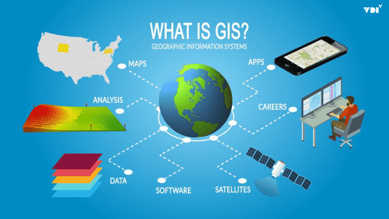
GIS provides a platform to integrate, manage, analyze, and visualize every type of water-related data on a single map. It turns dry numbers and tables into vivid spatial information, helping managers “see through” and “deeply understand” the river basins they are responsible for.
1. Building a River Basin Digital Map: A Foundation for Unifying Data
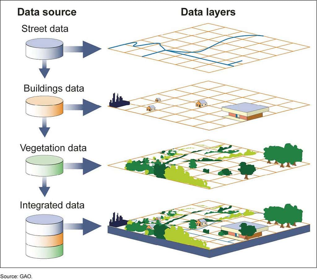
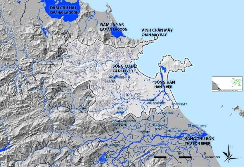
The first and most important step is to build a “digital twin” of the river basin. A GIS platform makes it possible to integrate and overlay key spatial datasets, including:
- Terrain base layer (DEM): Makes it possible to determine flow direction, delineate sub-basins, and simulate flood scenarios.
- Hydrographic network layer: The entire system of rivers, streams, canals, ditches, lakes, and dams, digitized in detail.
- Soil and vegetation cover layers: Provide essential information for analyzing infiltration, surface runoff, and erosion risk.
- Discharge source layer: Precisely locates factories, industrial zones, hospitals, concentrated residential areas, and points where wastewater is discharged into water bodies, together with detailed information on discharge volume and wastewater composition.
- Irrigation works layer: Locations of dams, reservoirs, pumping stations, regulating sluices, and more.
Creating a shared spatial database like this gives all stakeholders the same comprehensive and consistent view, breaking down the “data islands” between sectors and localities.
2. Monitoring and Warning: A Real-Time “Eye”
The power of GIS is multiplied when it is combined with Internet of Things (IoT) technology. Data from automatic water quality and flow monitoring stations is transmitted directly to the GIS in real time.
- Instant visualization: On the map, each monitoring station is a point that can change color or symbol based on the status of the water. For example, a point turns red and raises an alert if the pH or COD value exceeds the permitted threshold (QCVN, Vietnam’s national technical regulations).
- Building pollution warning models: This is one of the most valuable applications. When a pollution incident (for example, a chemical leak) is detected at a discharge point, the GIS can:
- Trigger a pollution propagation model, based on flow velocity and hydrological characteristics.
- Forecast the trajectory, extent, and timing of the pollution plume as it moves toward downstream areas.
- Automatically identify and send instant warnings to affected parties such as clean water plants and aquaculture areas, helping them respond in time.
3. Supporting Water Abstraction and Use Licensing
GIS makes licensing, an important management task, more transparent and more efficient.
All information on licenses for surface water and groundwater abstraction and use is managed on the map. Each license is a spatial object holding complete attribute information: license holder name, location, purpose of use, permitted flow, period of validity, and so on.
- When appraising new applications: Officials can easily check whether the requested location overlaps with other licenses and whether it lies within a prohibited or restricted abstraction area, making decisions more accurate and scientifically grounded.
- During inspections and audits: Leaders can easily query and view overall reports on licensing across the whole area, effectively supporting the monitoring of enterprises’ compliance.
4. Analysis and Planning: Tools for Strategic Decisions
Beyond operational management, GIS is a powerful spatial analysis tool that supports strategic planning and the sustainable protection of water resources.
- Identifying pollution “hot spots”: By overlaying maps of discharge sources, population density, and environmentally sensitive areas, GIS helps identify the areas with the highest pollution risk so that monitoring and remediation measures can be prioritized.
- Planning sanitary protection zones: The system can automatically delineate sanitary protection zones for domestic water intake areas based on hydrological principles, ensuring water source security.
- Assessing the carrying capacity of water bodies: By combining flow data with total discharge volumes, GIS supports calculating and assessing the wastewater receiving capacity of each river segment, providing a scientific basis for allocating discharge quotas.
Conclusion: Toward Smart and Sustainable Water Governance
It can be affirmed that GIS is no longer an option but has become an essential and mandatory tool on the path to modernizing water resources management. From building a comprehensive data picture and monitoring developments in real time to providing in-depth analysis for strategic planning, GIS is the key to moving from a passive, fragmented management approach to one that is proactive, integrated, and smart.
To pursue the goal of sustainable development and ensure national water security, investing in and applying GIS systematically is the inevitable direction.
Are Environmental Monitoring Centers, Irrigation Sub-departments, and Departments of Natural Resources and Environment looking for a breakthrough solution to strengthen their management capacity?
Contact UNIGIS. We are ready to work alongside you to build specialized GIS systems that are effective and best suited to practical conditions in Vietnam.