Overview
The Command Digital Map System is a solution installed at the Command Center of a Provincial Police (Công an tỉnh) department. It connects information sources that are currently fragmented — 113 emergency reports, cameras, radios with positioning, citizen reports, the 112/114/115 hotlines, and natural disaster warnings — into one shared digital map table, and carries orders from the command desk to officers and soldiers in the field.
The whole system is built around the principle of “one Incident file, many roles working from it”: each incident has a single code that follows it through every level, so citizens, duty officers, ward/commune police, field officers, and the Board of Directors all look at the same source of truth, and no unit has to re-enter another unit’s data. The system is installed in the Provincial Police’s data center and reuses existing cameras, radios, switchboards, and operational data instead of replacing them.
System components
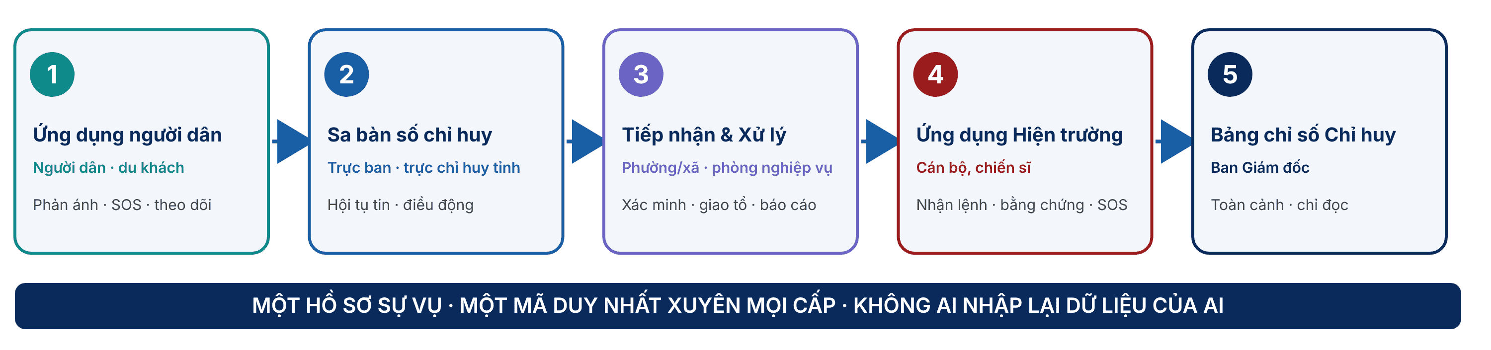
The system consists of five applications. Each serves a different group of users, but all read from and write to the same Incident file:
- Citizen & visitor app (citizens, visitors): the entry point for reports: submit a report with a photo and location, hold the SOS button for two seconds, and track the result with a code. Vietnamese and English, no account required.
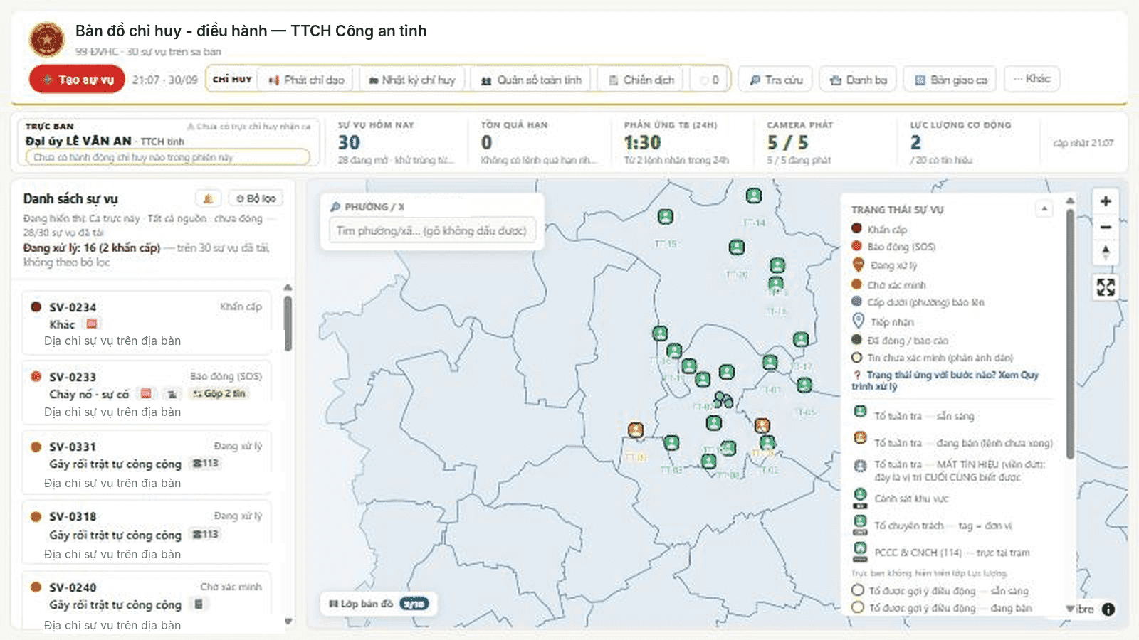
- Command digital map table (duty officers, provincial duty commanders): brings every source of information onto one map, merges duplicate reports into a single Incident, dispatches according to response plans and the nearest team, issues directives with an “acknowledged” confirmation, tracks orders, and keeps the command log.
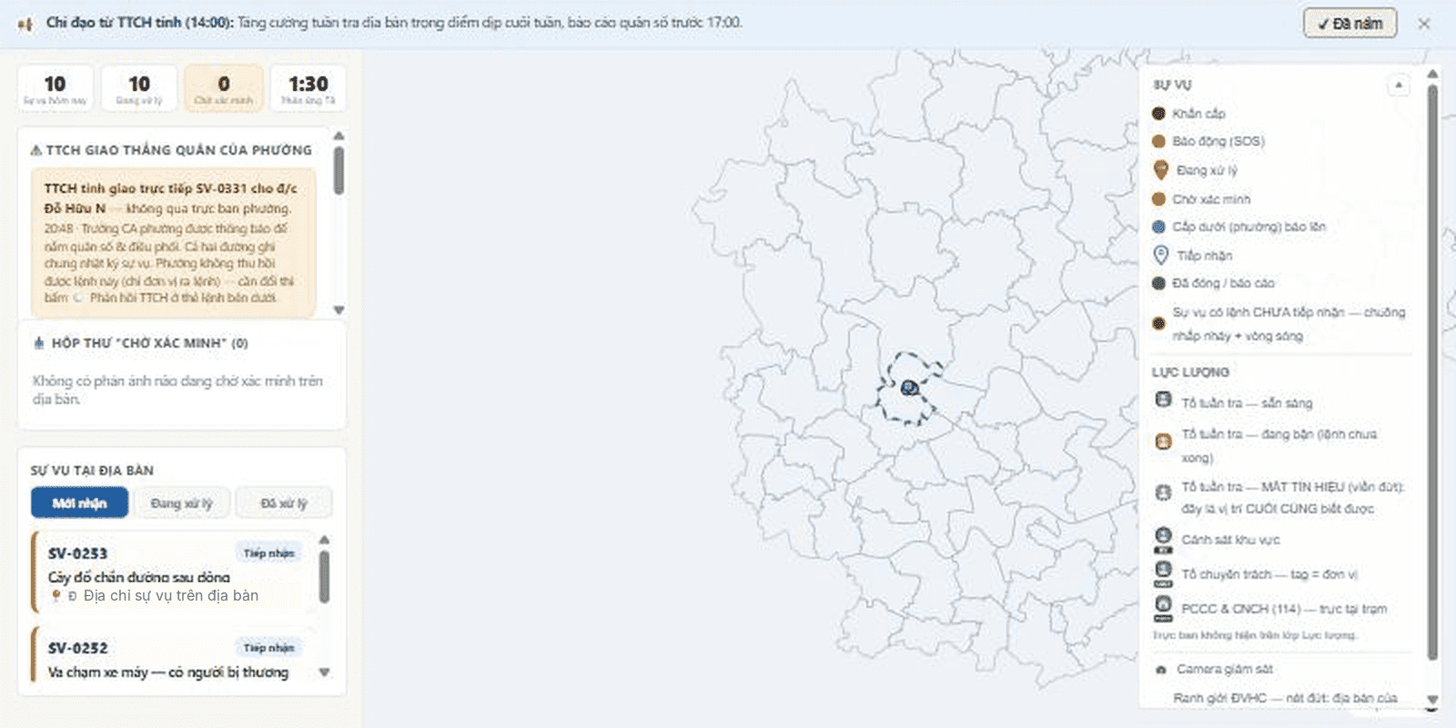
- Task Intake & Handling (ward/commune police, specialist departments): verify a report with one tap, create an incident at the local level, receive orders with an alert tone and countdown, assign teams, auto-draft reports, close an incident with a stated reason, and hand over shifts.
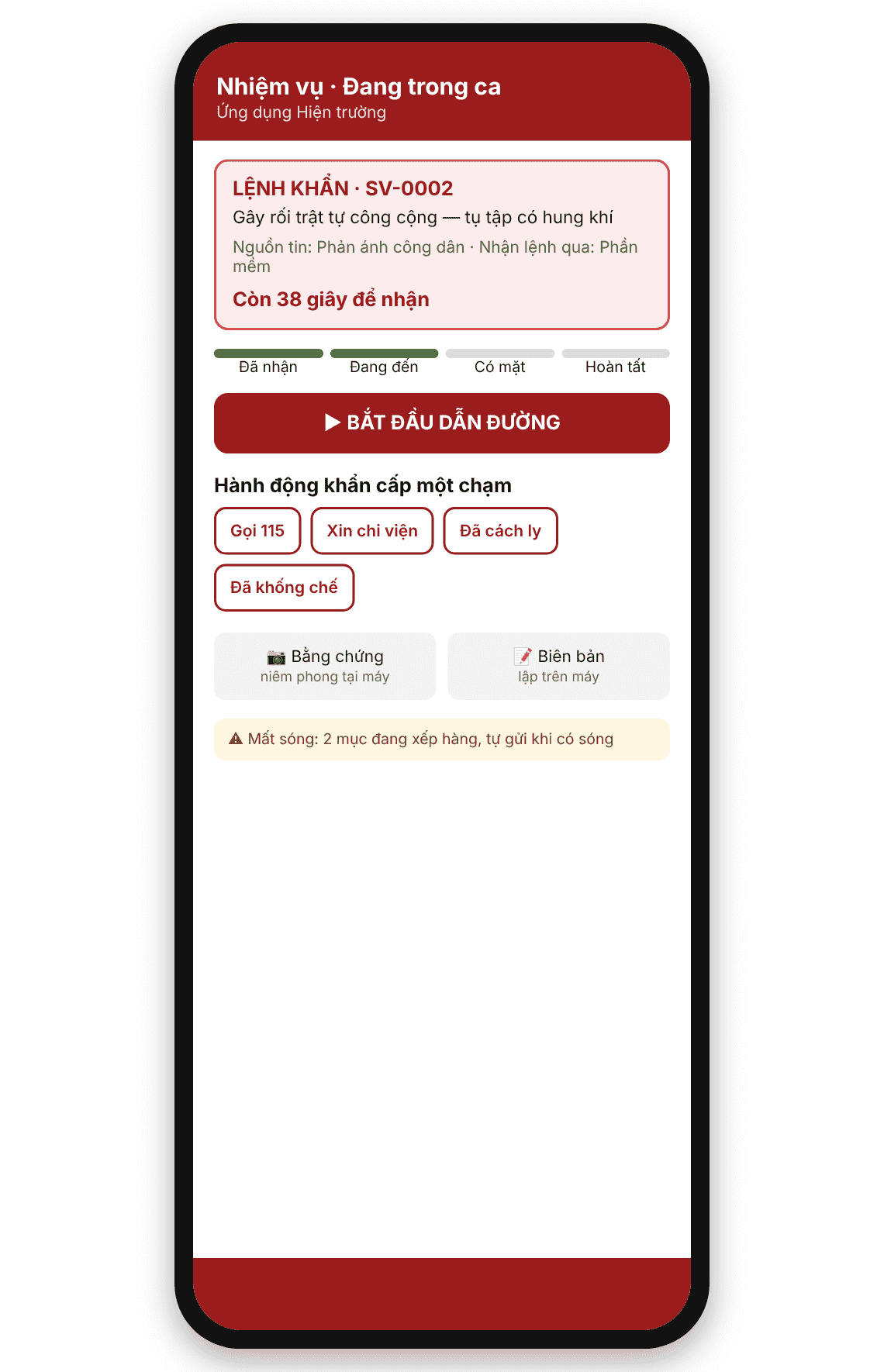
- Field app (officers and soldiers): a mobile app that receives orders, provides navigation, seals evidence, creates electronic records, offers six one-tap emergency actions and SOS — it works even without signal and sends automatically once signal returns.
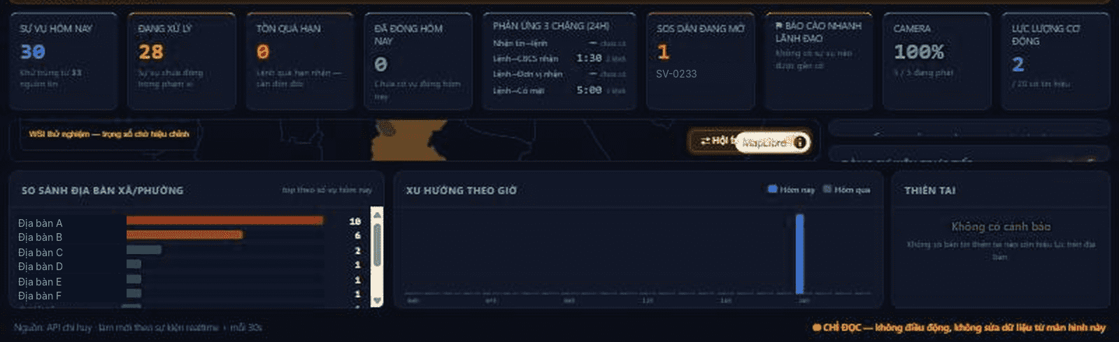
- Command Dashboard (Board of Directors): a large read-only screen showing the full operational picture in real time from the data being processed: three-stage response time, alerts, natural disasters, and special cases.
Key features
01. Every source of information on one digital map
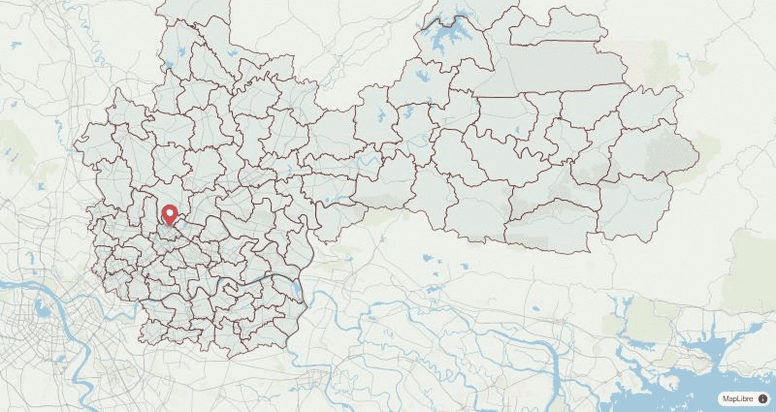
Incidents, unverified reports, patrol teams that change color in real time, cameras with active alerts, rain, flood, and landslide layers, and real administrative boundaries are all displayed on the same map.
02. Merge duplicate reports, one incident one code
Reports of the same type, close in location and time, are flagged as suspected duplicates; the duty officer merges three reports (113, camera, citizen) into one Incident while the trace of each report is preserved.
03. Dispatch by plan, with a complete order log
Dispatching by unit is the default; the system suggests plans by incident type and the nearest team by real location. Orders issued through the software, by radio, or by phone are all recorded in the order log — who gave the order, through which channel, who received it, and when they arrived.
04. Measured response time, not guessed
Three stages — report received → order issued, order issued → unit receives, order received → on scene — are calculated from server-recorded timestamps, showing exactly where delays occur.
05. A field app that works even without signal
Evidence is sealed on the device immediately, electronic records have auto-filled fields, urgent orders expand to full screen; all actions are queued when signal is lost and sent automatically, with their actual execution time, when signal returns.
06. Role-based access by jurisdiction, with every access logged
Each account is tied to a unit and a jurisdiction, enforced at both the application layer and the database layer. Sensitive data is more tightly restricted, and every view is recorded in a “who viewed what” log.
Deployment model
The solution is deployed on-premises, reuses the unit’s existing infrastructure, and is packaged in phases:
01. Installed in the Provincial Police data center
The system runs on-premises and does not use a public cloud. The network is divided into a core zone, a citizen zone, a sensor zone, and an administration zone; external touchpoints pass through a one-way boundary.
02. Connect existing infrastructure, no new purchases to get started
Cameras and video management systems, radios with positioning, switchboards, basemaps, and operational databases are connected rather than replaced; the system is ready to connect the 112/114/115 hotlines and natural disaster warning sources using international standards.
03. Two rounds of deployment, with acceptance at each milestone
Round 1 (about 8 weeks): a complete pilot version with the critical scenarios. Round 2 (about 34 weeks): survey and connect real devices, production hardening, security by classification level, penetration testing, redundancy, parallel running, training, and official operation.
Overall model: network zones and one-way boundaries – illustration.
Key advantages
- One Incident file across every level. A single code from the moment a citizen sends a report to the moment the incident is closed. Wards do not retype the province’s reports, the province does not retype the wards’ reports, and leaders do not wait for summaries.
- Business rules enforced by the server. Orders must be acknowledged, completion requires a report or a reason, closing an incident requires a reason, and lowering an alert level is a human decision — these rules, agreed with the duty staff, are enforced on the server rather than merely drawn into the interface.
- Software that works alongside the radio, not in place of it. An order given verbally is still entered in the order log with one tick, so response metrics have no gaps and can be audited afterward. The system does not issue orders by itself, merge reports by itself, or lower alert levels by itself.
- Trustworthy evidence and records. Photos, video, and audio are sealed on the official device and stored in a tamper-resistant repository; draft reports and handover packages for the Investigation Agency carry a verification code for each file.
- Defense-in-depth security. Designed to meet information system security requirements by classification level (target level 3 or higher); a lost device can be remotely revoked within about 30 seconds; officers can be tracked only during their duty shift.
Note: Measurements on the pilot build: the SOS signal reaches the map table in under 1 second; a citizen report verified by the ward reaches the provincial map table in under 30 seconds; the system sustains 2,000 position messages per second continuously. These figures are given to illustrate system latency and are not a commitment on the response time of the forces.
Documentation & contact
Send a request to schedule a 20-minute demonstration on real devices, using your own organization’s scenarios.
Contact: Lê Văn Hưng — Business Director, UNIGIS JSC · Email: hungle@unigis.vn