In the digital age, imagery acquired from satellites, aircraft, and drones has become an invaluable resource, offering deep insights into our planet. However, to turn this raw data into useful, actionable information, we need powerful analysis tools built on a solid scientific foundation. ENVI (Environment for Visualizing Images), developed by NV5 Geospatial, is the world’s leading solution, trusted by scientists, researchers, and analysts to process and extract information from every type of remote sensing imagery.
ENVI is not just an image viewer, but a comprehensive image analysis laboratory, providing advanced algorithms and a flexible workflow to solve the most complex problems, from agriculture and the environment to security and defense.
ENVI (Base License): A Comprehensive Analysis Platform
The heart of the ENVI ecosystem is the Base License. This is not a limited edition, but a full, powerful toolset that provides all the essential functions needed for a complete remote sensing analysis workflow, from data input to the creation of final products.
Technical Capabilities
- Outstanding data interoperability: ENVI can read and write hundreds of image, vector, and point data formats from almost every sensor and software platform in the world. This breaks down every data barrier, allowing you to work seamlessly in a single environment.
- Data correction and preparation: Provides a full set of tools for geometric correction (bringing imagery to the correct map coordinates) and basic radiometric correction, ensuring your data has reliable positional accuracy and spectral values for analysis.
- Data visualization and exploration: Lets you easily change band combinations to highlight different features, for example highlighting healthy vegetation with a false-color composite.
- General spectral analysis: Includes built-in tools to calculate dozens of common spectral indices such as NDVI (vegetation index), NDWI (water index), SAVI (soil-adjusted vegetation index), and more, helping you quickly extract thematic information.
- Image classification: Provides a full range of supervised and unsupervised classification algorithms, allowing you to accurately create land cover and forest cover maps.
- Workflow automation: Integrates the visual programming interface ENVI Modeler, which lets you build complex processing workflows by dragging and dropping and connecting tools, then rerun them automatically to process large datasets, saving time and ensuring consistency.
Practical Applications
With this comprehensive toolset, users can solve a wide range of real-world problems:
1. Precision Agriculture Management
In modern agriculture, monitoring crop health at large scale is critical. Using free satellite imagery such as Sentinel-2, users can apply ENVI’s NDVI calculation tool. The result is a visual map clearly showing areas where crops are thriving (high NDVI values, dark green) and areas with problems such as water or nutrient deficiency (low NDVI values, yellow and red). Based on this map, farmers can make precise farming decisions, applying fertilizer or irrigation only where it is truly needed, saving costs and increasing yields.
2. Water Resources Monitoring
Reservoirs, rivers, and wetlands are important resources that need continuous monitoring. Using the historical Landsat imagery archive, hydrologists can use ENVI to calculate the NDWI index. This process can be automated to handle hundreds of images over several decades, producing a series of maps showing changes in water surface area. This analysis is extremely useful for assessing the impact of climate change, managing water resources for hydropower and agriculture, and conserving important wetland ecosystems.
3. Basic Land Cover Mapping
Before carrying out planning projects or environmental impact assessments, the first requirement is a map of current land cover. With aerial imagery or high-resolution satellite imagery, ENVI’s unsupervised classification algorithm automatically groups pixels with similar spectral characteristics into clusters. The analyst then only needs to assign a meaning to each cluster (for example, cluster 1 is “urban area,” cluster 2 is “forest,” cluster 3 is “water surface”) to quickly produce a basic land cover map for the entire study area.
4. Data Preparation for GIS
Drone data is often geometrically distorted and stored in separate files. ENVI provides a powerful workflow to handle this problem. Users can apply orthorectification tools to remove distortions, then mosaic hundreds of individual drone images together. The result is a single, seamless basemap file with ultra-high resolution and reliable positional accuracy, ready to be brought into GIS systems such as ArcGIS Pro as a base layer for digitizing, asset management, and detailed planning.
5. Rapid Change Detection
When a quick assessment of change between two dates is needed, for example before and after a flood or to check for deforestation, ENVI’s image differencing technique is an extremely effective tool. By subtracting the pixel values of the earlier image from the later image, areas with no change will have values close to zero, while areas with major change (for example, forest turning into bare land) will show up as prominent bright or dark zones. This helps managers quickly delineate hotspots that require more detailed investigation.
Conclusion
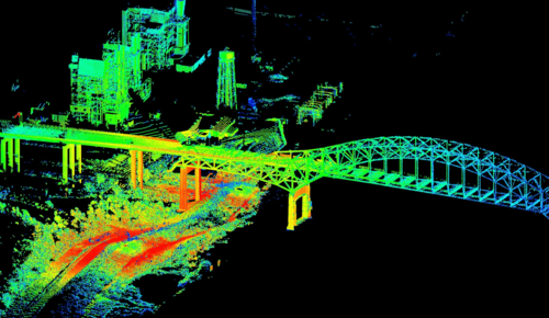
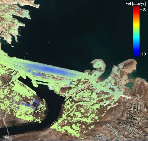
The ENVI Base License is not just a starting point but a powerful and complete image analysis solution. It provides all the scientific tools professionals need to confidently turn remote sensing data into detailed, reliable insights that underpin countless real-world applications. From this solid foundation, users can continue to expand their capabilities with other specialized modules such as atmospheric correction, LiDAR processing, deep learning, or SAR radar analysis.